Trouvez-nous sur Facebook!à PROPOSLareau est un cabinet en assurance de dommages et de services financiers, solidement implanté au Québec, qui traite avec la majorité des compagnie...more...See more text
Land Surveyors, Certificate Of Location, Staking, Boundary Marking, Site Plan, Cadastral Operation, Technical Description, Cadastral Plan, Cadastral Survey, Topographic Survey, Subdivision Plans, Housing Development, Site Plans, Layout, Structure , Pile And Axis Layout, Boma, Lot Grading Plan, Digital Terrain Modelling (DTM)
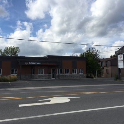
By working with Denicourt Land Surveyors, enjoy a personalized service and the guarantee of a job well done. Fuelled by our many years of experience, we prepare official documents ...more...See more text
Land Surveyors, Certificate Of Location, Staking, Boundary Marking, Site Plan, Cadastral Operation, Technical Description, Cadastral Plan, Cadastral Survey, Topographic Survey, Subdivision Plans, Housing Development, Site Plans, Layout, Structure , Pile And Axis Layout, Boma, Lot Grading Plan, Digital Terrain Modelling (DTM)
By working with Denicourt Land Surveyors, enjoy a personalized service and the guarantee of a job well done. Fuelled by our many years of experience, we prepare official documents ...more...See more text
149 Rue Jacques-Cartier Nord, Saint-Jean-sur-Richelieu, QCJ3B 6S7Get directions
Cartographie, Arpentage Topographique, Arpentage Hypothécaire, Subdivision D'espace Aérien, Lotissement, Arpentage De Construction, Levé Cadastral, Arpentage Commercial, Topographie, Plan De Cadastre, Subdivision Cadastrale
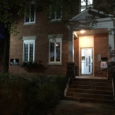
Basé à Saint-Jean-sur-Richelieu, Yves Madore Arpenteur-Géomètre offre des services de cartographie, de topographie et de subdivision d'espace aérien. Il offre également des service...more...See more text
1009 rue Notre-Dame, Saint-Rémi, QCJ0L 2L0Get directions
Land Surveyors, Staking, Boundary Marking, Site Plan, Cadastral Operation, Technical Description, Cadastral Survey, Topographic Survey, Subdivision Plans, Housing Development, Site Plans, Layout, Structure, Pile And Axis Layout, Boma, Lot Grading Plan, Digital Terrain Modelling (DTM), Certificate Of Location, Cadastral Plan
By working with Denicourt Land Surveyors, enjoy a personalized service and the guarantee of a job well done. Fuelled by our many years of experience, we prepare official documents ...more...See more text
1009 Rue Notre-Dame Gd, Saint-Rémi, QCJ0L 2L0Get directions
Land Surveyors, Certificate Of Location, Staking, Boundary Marking, Site Plan, Cadastral Operation, Technical Description, Cadastral Plan, Cadastral Survey, Topographic Survey, Subdivision Plans, Housing Development, Site Plans, Layout, Structure , Pile And Axis Layout, Boma, Lot Grading Plan, Digital Terrain Modelling (DTM)
By working with Denicourt Land Surveyors, enjoy a personalized service and the guarantee of a job well done. Fuelled by our many years of experience, we prepare official documents ...more...See more text
Levé Cadastral, Mesure, Certificat De Localisation, Droit Foncier, Mesurage, Plan Topographique, Implantation De Pieux Et D'axes, Piquetage, Bornage, Description Technique, Projet D'implantation, Arpenteurs-Géomètres, Levé topographique, Plan De Cadastre, Projet Lotissement, Modèle Numérique De Terrain (MNT), Plan De Nivellement De Terrain, Boma, Opération Cadastrale